A 1-week Advanced Technical Training Program on “RS & GIS applications in Civil Engineering”, for Fresh Civil Engineers, Students and Faculty is happening at Vasireddy Venkatadri Institute of Technology, Nambur, from 18 December 2017 and will be conducted till 23 December 2017.
A renowned International Researcher Dr V. Rajesh Chowdhary, Research Associate, Remote Sensing & GIS –ICT, School Engineering & Technology, Asian Institute of Technology, Klong Luang, Thailand, is acting as the eminent Resource Person. The participants of this Training Program are very much fortunate to get the Unique Information from the highest available resource on this RS & GIS domain.

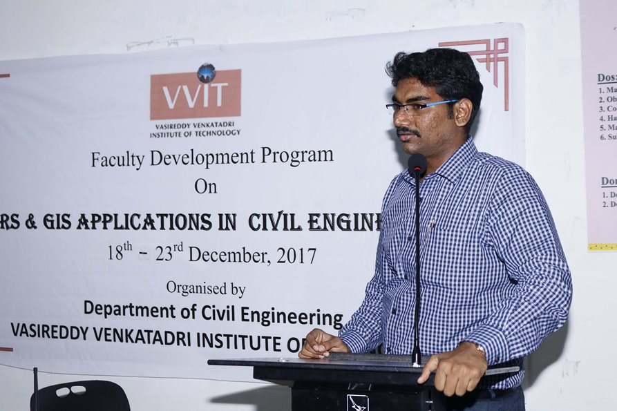
Dr V. Rajesh Chowdary, during his inaugural speech on the first day of program, inspired the participants about the importance of Remote Sensing and Geographic Information System now a days and its applications in Civil Engineering in a nutshell. He said for the remaining days of training program, more interesting applications will be explored with a practical approach by using the live Remote Sensing Data. Dr.Rajesh, emphasized that, the integration of Remote sensing into the Geographic Information System can address many challenging issues facing by the mankind, by implementing Emergency Response Systems, Storm water drainage , flood vulnerability, spatio-temporal analysis of land surface, identification of Vulnerable zones etc., which are recently addressed in AgTech Summit at Vizag, while discovering the sustainability of agriculture in Andhra Pradesh, by the World Popular Entrepreneur Bill Gates and Hon.ble Chief Minister Sri Nara Chandrababu Naidu of AP.
Dr. Rajesh commended the efforts of VVIT for organizing this kind of Advanced Training Programs for the budding Engineers to make them enough skillful and aware of technology utilization for the betterment of Society and mankind. He appreciated the participants for being active learners and wished them to achieve all the objectives of this program.
Dr.Y.Mallikarjuna Reddy, Principal of VVIT, informed that, GIS is a computer-based tool for mapping and analyzing feature events on earth and Remote Sensing is the art and science of making measurements of the earth using sensors on airplanes or satellites. These sensors collect data in the form of images and provide specialized capabilities for manipulating, analyzing, and visualizing those images. Dr. Reddy informed that VVIT is always a step ahead in organizing this kind of Advanced Training Programs, for the benefit of their stake holders.Dr.T.Sridhar Babu, Head, Civil Engineering informed that for the aspiring Civil Engineers in the domain of RS& GIS this program will serve the most promising content.

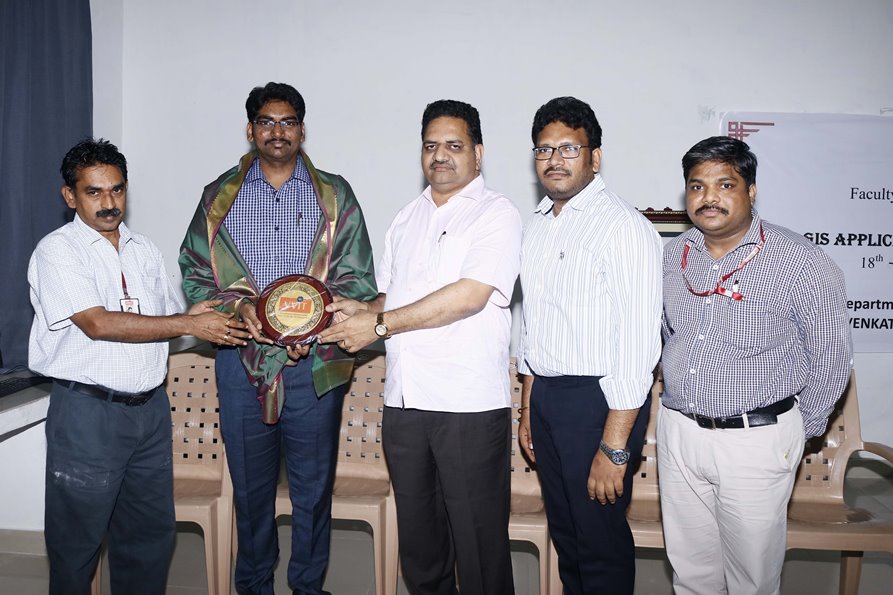
Dr.Sridhar Babu, said every Civil Engineering student must be aware of this technology for integrating their core knowledge with it.Convener of this Training program Prof. N.Kumara Swamy, Dean of Academics,VVIT, in this regard informed that the forthcoming sessions in the remaining days will focus on the introduction to RS, GIS & GNSS, how to develop map making skills using open source software, to design geo database using open data sources, to develop the necessary skill of handling the digital maps, satellite data and GPS assisted primary database development in a hands on environment with data collected via satellite imagery. Certificates and Material shall be provided for all the participants as informed by the Convener.Sri VidyaSagar, Chairman, Sri Badari Prasad, Secretary, Sri M.SreeKrishna, Joint Secretary, Dr.Y.Mallikarjuna Reddy, Principal, Dr. T.Sridhar Babu, HOD, Civil Engineering, Prof.N.KumaraSwamy, Dean Academics, the Faculty, Students of Civil Department of VVIT and registered candidates from nearby institutes were participated in this one week Advanced Technical Training program on the Civil Engineering Applications of RS & GIS.

Dr V. Rajesh Chowdary, during his inaugural speech on the first day of program, inspired the participants about the importance of Remote Sensing and Geographic Information System now a days and its applications in Civil Engineering in a nutshell. He said for the remaining days of training program, more interesting applications will be explored with a practical approach by using the live Remote Sensing Data. Dr.Rajesh, emphasized that, the integration of Remote sensing into the Geographic Information System can address many challenging issues facing by the mankind, by implementing Emergency Response Systems, Storm water drainage , flood vulnerability, spatio-temporal analysis of land surface, identification of Vulnerable zones etc., which are recently addressed in AgTech Summit at Vizag, while discovering the sustainability of agriculture in Andhra Pradesh, by the World Popular Entrepreneur Bill Gates and Hon.ble Chief Minister Sri Nara Chandrababu Naidu of AP.
Dr. Rajesh commended the efforts of VVIT for organizing this kind of Advanced Training Programs for the budding Engineers to make them enough skillful and aware of technology utilization for the betterment of Society and mankind. He appreciated the participants for being active learners and wished them to achieve all the objectives of this program.
Dr.Y.Mallikarjuna Reddy, Principal of VVIT, informed that, GIS is a computer-based tool for mapping and analyzing feature events on earth and Remote Sensing is the art and science of making measurements of the earth using sensors on airplanes or satellites. These sensors collect data in the form of images and provide specialized capabilities for manipulating, analyzing, and visualizing those images. Dr. Reddy informed that VVIT is always a step ahead in organizing this kind of Advanced Training Programs, for the benefit of their stake holders.Dr.T.Sridhar Babu, Head, Civil Engineering informed that for the aspiring Civil Engineers in the domain of RS& GIS this program will serve the most promising content.

Dr.Sridhar Babu, said every Civil Engineering student must be aware of this technology for integrating their core knowledge with it.Convener of this Training program Prof. N.Kumara Swamy, Dean of Academics,VVIT, in this regard informed that the forthcoming sessions in the remaining days will focus on the introduction to RS, GIS & GNSS, how to develop map making skills using open source software, to design geo database using open data sources, to develop the necessary skill of handling the digital maps, satellite data and GPS assisted primary database development in a hands on environment with data collected via satellite imagery. Certificates and Material shall be provided for all the participants as informed by the Convener.Sri VidyaSagar, Chairman, Sri Badari Prasad, Secretary, Sri M.SreeKrishna, Joint Secretary, Dr.Y.Mallikarjuna Reddy, Principal, Dr. T.Sridhar Babu, HOD, Civil Engineering, Prof.N.KumaraSwamy, Dean Academics, the Faculty, Students of Civil Department of VVIT and registered candidates from nearby institutes were participated in this one week Advanced Technical Training program on the Civil Engineering Applications of RS & GIS.


